
Experience immediate, latency-free exploitation with our real-time 3D reconstruction, metrological terrain analysis, and embedded AI-powered scene understanding.
From the very start of your data capture mission—and continuously as it progresses—you gain instant access to 3D terrain mapping, precise measurements, and real-time AI analysis such as object detection and tactical interpretation.
Our technology ensures that images are fused into the map and analyzed instantly, without waiting for the drone to return to base.
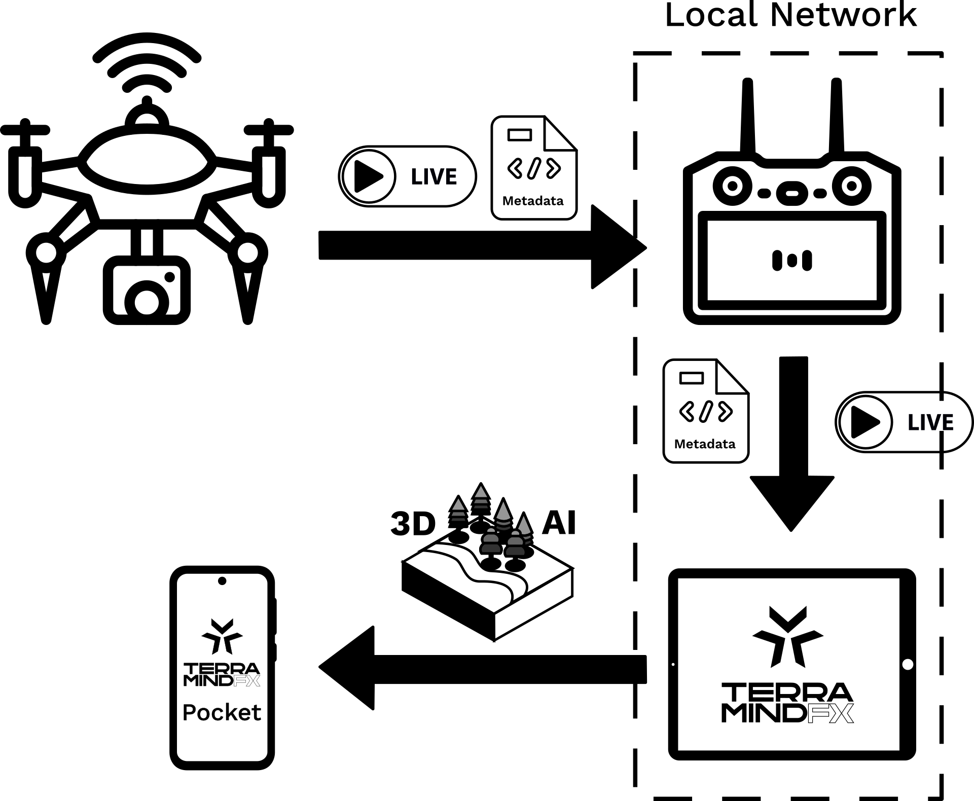
1. Connect to a live UAV feed and reconstruct the terrain in 3D in real-time during the flight.
2. Dive into the reconstruction of the terrain, explore the 3D map using free-viewpoint navigation while the UAV collect data.
3. Immediately perform real-time terrain analysis such as measurements, detection of threats, landing zone detection and ground path planning.
4. Export and distribute 3D maps and analytics to remote video terminals via any Web browser.